Tropical Storm Gordon
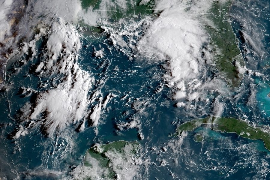
Tropical Storm Gordon in the Gulf of Mexico
September 4, 2018
After months of barely any tropical cyclone activity, the 2018 hurricane season is now starting to heat back up.
Monday morning, the National Hurricane Center officially declared potential tropical cyclone seven as a tropical storm named Gordon.
Gordon developed while over the Florida Keys, reaching warmer waters in which allowed it to strengthen at a rapid pace, right before moving over land causing several tropical storm warnings to be issued for South Florida.
On Monday, Palm Beach County saw steady winds of about 20 mph at times, with wind gusts to even higher speeds.
Now Gordon is in the Gulf of Mexico, moving at a fast pace at 15 MPH. The warm waters of the Gulf are fuel for tropical cyclones, and is what is allowing Gordon to strengthen to hurricane status.
Gordon is currently on its way to Louisiana and Mississippi, where it is predicted to make landfall as a category one hurricane. Hurricane warnings have been issue for much of the coastline of Mississippi and Alabama, and tropical storm warnings have been issued for a large part of coastal Louisiana and parts of the Florida panhandle.
Residents residing in the warning areas only have had two days to prepare, doing whatever they can to protect their property from the storm.
Gordon will make landfall late Tuesday, and will be the second storm this season to make landfall in the United States, the first being subtropical storm Alberto.


